About New Light Technologies
Real-Time Flood Insights: How NLT and ICEYE Partner to Support FEMA
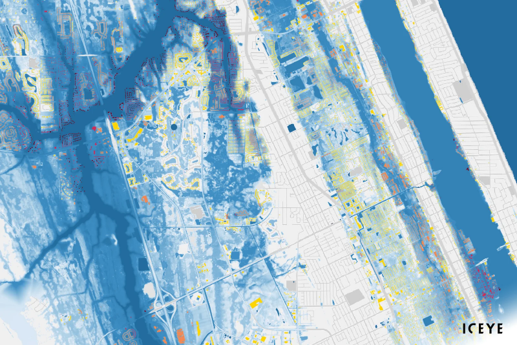
NLT and ICEYE partner to provide real-time insights on major flood events across the U.S. for FEMA.
ICEYE's satellite data revolutionizes FEMA's flood response, providing crucial insights for immediate action during natural disasters.
ICEYE, a world-leading provider of natural catastrophe solutions and insights, has delivered crucial flood insights over the past several months to the Federal Emergency Management Agency (FEMA). Delivered through ICEYE’s partnership with New Light Technologies (NLT) and Bana Solutions (Bana), ICEYE’s rapid flood extent and depth information have now supported FEMA’s immediate response efforts for four major flood events.

When large-scale natural catastrophes impact communities, it is critical that emergency response activities are not delayed in remote locations, or due to ongoing storm conditions and cloud cover. ICEYE owns the world's largest synthetic-aperture radar (SAR) satellite constellation and utilizes multiple auxiliary information sources in providing near real-time flood extent and depth data for critical decision-making during storm events. Unlike conventional Earth observation satellites, ICEYE’s small radar imaging satellites can form high-resolution images of areas of the Earth in daylight, at night, and even through cloud cover and rain.
NLT’s team supporting the FEMA Response Geospatial Office (RGO) developed automated data delivery pipelines for integrating
ICEYE’s novel flood data for the July floods in Kentucky, coastal flooding in Alaska, Hurricane Fiona in Puerto Rico, and Hurricane Ian's affected areas.
“ICEYE’s data significantly improves the ability to monitor weather events and their impacts on communities while serving as a key input to NLT’s disaster response models, revolutionizing the speed and accuracy of the analytics we supply to our customers,” said Dr. Ran Goldblatt, Chief Scientist of New Light Technologies.
According to New Light Technologies’ Program Manager Robert Pitts, this data has proven to be invaluable to FEMA for their response during events such as Hurricane Ian and Hurricane Fiona.
ICEYE delivers unmatched persistent monitoring capabilities for any location on earth. Owning the world’s largest synthetic-aperture radar constellation, the company enables objective, data-driven decisions for its customers in sectors such as insurance, natural catastrophe response and recovery, security, maritime monitoring and finance. ICEYE’s data can be collected day or night, and even through cloud cover. For more information, please visit www.iceye.com
New Light Technologies Inc. (NLT) is a leading provider of integrated science, technology, and mission services. Offering renowned expertise in cloud, agile software development, cybersecurity, data science, geospatial and remote sensing, NLT provides comprehensive consulting, research, digital transformation services, and fit-for-purpose analytics solutions for a range of industries from emergency management to economics to health. The firm has pioneered real-time geospatial AI/ML predictive analytics platforms for government and industry and led the development of novel methods for leveraging satellite imagery to support disaster response, climate resiliency, impact evaluation, and sustainable development missions worldwide. To learn more visit www.newlighttechnologies.com and follow us on Twitter at @NewLightTech.
NLT and ICEYE partner to provide real-time insights on major flood events across the U.S. for FEMA.
New Light Technologies (NLT) and Planet collaborate to provide FEMA with satellite imagery for enhanced disaster response.
NLT and Nearmap collaborate to deliver rapid aerial imagery and AI-powered property intelligence for FEMA disaster response, powered by NLT's IMPACT...