NLT’s Chief Scientist and Senior Consultant Ran Goldblatt worked in partnership with International Initiative for Impact Evaluation (3ie) to lead a workshop on remote sensing and satellite imagery. Working with ten researchers from the African Population and Health Research Center (APHRC), the workshops focused on using geospatial data for impact evaluation from remote sensing technology. Participants of the event have written a series of four blogs about their experiences and findings from the event as part of 3ie’s blog series, Evidence Matters.
What's Inside?
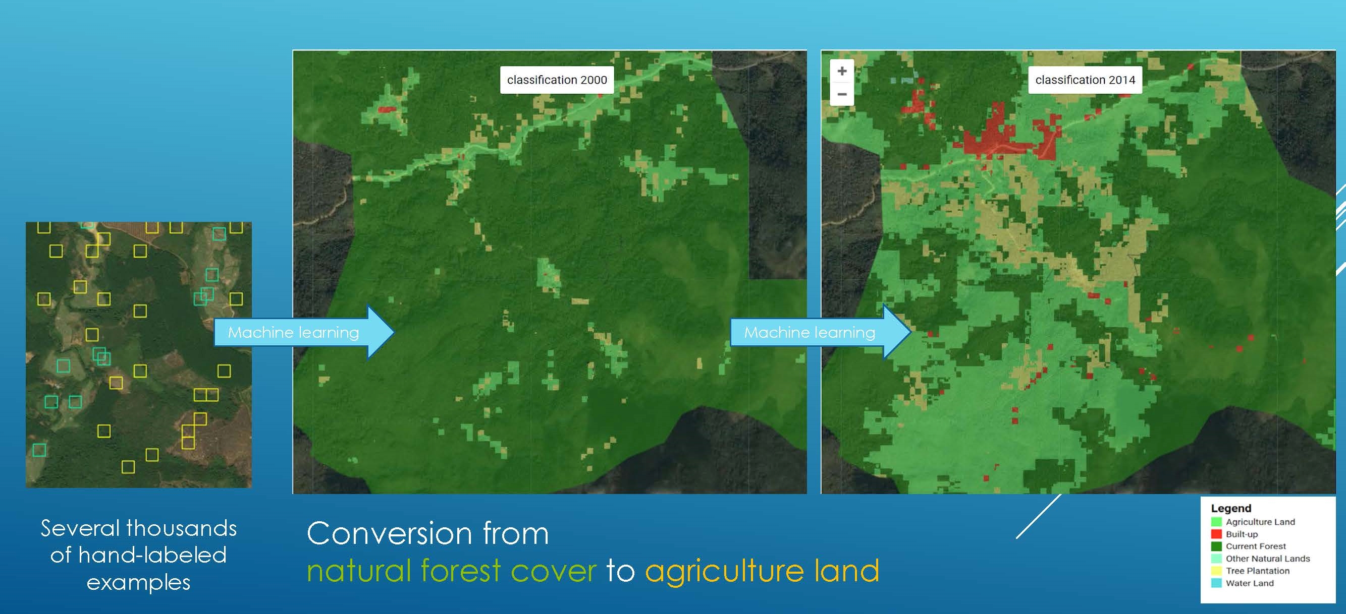
The first blog in the series written by Sylvia Myuingo, Moussa Bagayoko, Aayush Malik, and Ran Goldblatt focuses on machine learning and remote sensing as new evaluation tools in impact evaluation. Read the first blog post as part of Evidence Matters.
Image from 3ie’s Evidence Matters.
The second blog in the series written by Dennis Akeyo, Henry Owoko, Aayush Malik, and Ran Goldblatt focuses on using geospatial data for measuring vegetation impact on agricultural productivity. Read the second blog post as part of Evidence Matters.
Image from 3ie’s Evidence Matters.
The third blog in the series written by Michelle Mbuthia, Francis Kiroro, Aayush Malik, and Ran Goldblatt focuses on mapping the impact of urbanization on vegetation in Nairobi. Read the third blog post post as part of Evidence Matters.
Image from 3ie’s Evidence Matters.
The fourth and final blog in the series focuses on applications of nighttime light data in international development research. Read the fourth blog post as part of Evidence Matters.
Image from 3ie’s Evidence Matters.
About New Light Technologies
New Light Technologies, Inc. (NLT) is a leading provider of integrated information technology, technical, scientific, consulting, and research services based in Washington, DC. NLT provides a broad range of integrated cloud, agile software development, cybersecurity, data science, geospatial, and workforce services and ready-to-use solutions for customers and offers distinctive capabilities in developing secure cloud-native AI/ML data analytics and decision support tools. The firm also provides unique expertise in developing, implementing, and managing enterprise solutions that enable the collection, integration, modeling and analysis, privacy protection, quality control, visualization, and public release of large-scale datasets and web-based data dissemination platforms. Contact us for more information and set up a conversation with our team members at a conference, or get on our chatbot, and we’ll be on standby to get you connected with our team on the conference floor. Visit https://newlighttechnologies.com
Join NLT at the GEO S.W.R.M. Symposium 2023 in St. Louis, MO. Dive into geospatial AI, satellite imagery, & severe weather resilience w/ industry...
Ghermay Araya + Ran Goldblatt
Aug 25, 2023
Get notified on new blog posts
Stay updated with the latest insights and innovations from our experts. Subscribe now to receive exclusive content, industry updates, and behind-the-scenes looks at our team's work.