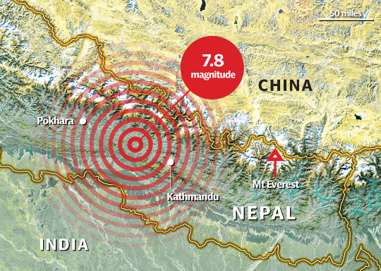
On April 25, 2015, an earthquake that registered 7.8 on the Richter scale struck Northwest of Kathmandu, Nepal. The projected initial death totals surpassed 5,000 with many more expected as cascading effects begin to work their way through the country. After an event of this magnitude in a developing country, the largest problem is identifying resource needs, moving those resources, and identifying areas of concern. In Nepal Kathmandu has been mapped extensively due to it being a subject of the Open Cities Project however, the surrounding areas were severally lacking data. This keeps responders from identifying homes, persons, and infrastructure in need of assistance.
MapImage from the Telegraph(UK) which has a great site as well for learning more about the earthquake.
Due to the great need of data, organizations and people throughout the world are donating time mapping spatial information throughout the country.
This information is collected by a crowd of volunteers using Open Street Maps and goes live into the maps immediately. This information is the major source of spatial information for countries where the Red Cross has activities. New Light Technologies decided to take part in the efforts by holding a mapping event with employees and sent personnel to a large-scale collaborative mapping event as well. This event was hosted by various organizations including but not limited to The American Red Cross (http://www.redcross.org/), Missing Maps (http://www.missingmaps.org/), Humanitarian Open Street Maps (http://hotosm.org/), and Maptime DC (http://www.meetup.com/Maptime-DC/events/220505118/).