From Grassroots Vision to the Premier Federal Geospatial Event
In the ecosystem of federal technology conferences, few events have demonstrated the organic growth trajectory and sustained mission focus quite like FedGeoDay. What began as a modest gathering of open-source geospatial enthusiasts has evolved into the premier two-day conference for federal geospatial intelligence and analytics professionals in Washington, D.C., and New Light Technologies has been privileged to witness and contribute to this remarkable transformation from the very beginning.
The evolution of FedGeoDay mirrors the broader transformation of geospatial technology itself within federal agencies; from niche applications managed by specialized teams to mission-critical infrastructure that underpins decision-making across emergency management, national security, environmental monitoring, urban planning, and humanitarian operations. As agencies like FEMA, NASA, and the U.S. Census Bureau have expanded their reliance on sophisticated geospatial analytics platforms to address increasingly complex challenges, FedGeoDay has grown alongside them, creating a vital forum for exchanging ideas, methodologies, and collaborative frameworks that advance the entire federal geospatial community.

For New Light Technologies, participation in FedGeoDay has never been about mere conference attendance; it is a natural extension of the company's core mission. Open geospatial technology is woven into the fabric of NLT's daily operations, from disaster management platforms that deliver real-time situational awareness during catastrophic events to data integration pipelines that process petabytes of satellite imagery for climate resilience applications. When FedGeoDay emerged as a grassroots effort to champion open-source geospatial ecosystems across the federal government, NLT's involvement was inevitable, and the company has maintained its commitment to this community-driven initiative year after year.
Witnessing the Journey: A Front-Row Seat to Evolution
Over the past several years, NLT has occupied a front-row seat to FedGeoDay's remarkable evolution, observing firsthand how a single-day conference has matured into a two-day gathering that attracts federal program managers, technology leaders, industry partners, NGOs, and open-source advocates from across the nation. Each successive year has brought expanded energy, deeper technical conversations, and a strengthening community that transcends organizational boundaries and mission areas.
The event's resilience has been tested and proven: FedGeoDay successfully navigated the challenging shift to virtual formats during the pandemic, maintaining continuity and connection when physical gatherings became impossible. The return to in-person engagement, particularly the 2024 event held at the Department of the Interior's Yates Auditorium, demonstrated with clarity the irreplaceable value of face-to-face interaction, shared learning experiences, and the organic networking that occurs when passionate professionals gather in the same physical space to advance their collective mission.
Through venue changes, evolving thematic focuses, and expanding attendance numbers, one constant has remained at the heart of FedGeoDay: its people. The federal geospatial community is characterized by its collaborative spirit, its commitment to open standards and interoperability, and its dedication to leveraging technology in the service of the public good. FedGeoDay serves as both a reflection and a catalyst of these values, creating an annual touchpoint where relationships are strengthened, innovations are shared, and the future direction of federal geospatial intelligence is collectively shaped.

The Remarkable Volunteers Who Make It Happen
Events of FedGeoDay's caliber and impact do not materialize through happenstance; they are the result of sustained dedication, strategic vision, and countless volunteer hours contributed by individuals who believe deeply in the mission. The FedGeoDay Planning Committee represents a remarkable cross-section of the federal geospatial community, bringing together leaders from government agencies, private industry, academic institutions, and nonprofit organizations who collectively possess the expertise, networks, and passion required to orchestrate an event of this magnitude.
The committee's composition reads as a who's who of federal geospatial leadership: Bill Dollins of Cercana Systems serves as co-chair, bringing his extensive industry experience and strategic vision to the event's direction. Maggie Cawley of OpenStreetMap US contributes deep expertise in collaborative mapping initiatives that have transformed humanitarian response operations worldwide. Jackie Kazil of Bana Solutions and Dan Joseph of the American Red Cross provide perspectives from the disaster response community, where geospatial analytics serves as life-saving infrastructure during crisis events.
Representatives from the U.S. Census Bureau: including Monica Mardel, Karla Riso, and Michael Arthur: bring insights from one of the federal government's most sophisticated data stewardship operations, where geospatial intelligence underpins constitutional mandates and democratic processes. The team from Motivf, including Jaymes Cloninger, Julie Kim, Chad Blevins, and Bob Ruediger, contributes cutting-edge technical expertise in cloud-native architectures and modern data platforms. Aaron Kelley of Upslope Advisors, Wayne Hawkins of RGi, Terry Busch of AI Research Corporation, Puneet Kollipara, Jessi Breen of American University, David Carter (Chief Data Officer at the Department of Interior), John Crowley of MapAction, Ryan Burley of GeoSolutions, and Sam Stehle of the Cartography and Geographic Information Society each bring unique perspectives that enrich the event's content and expand its reach across diverse constituencies.
NLT's own Ghermay Araya, founder and CEO, has been honored to serve on this distinguished committee, contributing to the event's strategic direction while ensuring that the operational realities faced by federal agencies in deploying geospatial analytics at scale remain central to the conference's programming. Ghermay's dual perspective: as both a technology provider delivering solutions to agencies like FEMA, NASA, and the Census Bureau, and as a committed member of the open geospatial community: enables him to bridge the often-challenging gap between technological possibility and operational implementation.

Eddie Pickle: The Steady Hand at the Wheel
If FedGeoDay possesses a single individual who serves as its organizational backbone, its institutional memory, and its connective tissue across the sprawling federal geospatial community, that individual is unquestionably Eddie Pickle. Year after year, Eddie has provided the steady leadership, deep relationship networks, organizational discipline, and unwavering commitment required to ensure that FedGeoDay not only occurs but thrives and expands in impact.
Currently serving as Senior District Manager for U.S. Public Sector at Snowflake, Eddie brings a unique combination of private-sector operational expertise and genuine passion for the federal geospatial community. His ability to navigate complex stakeholder landscapes, secure venues and resources, attract high-caliber speakers and sponsors, and maintain continuity across multiple event cycles has proven indispensable. Eddie's fingerprints are evident on every successful FedGeoDay iteration; his contributions extend far beyond logistics and coordination to encompass strategic vision, community building, and the cultivation of an inclusive environment where diverse perspectives are welcomed and amplified.
To Eddie Pickle and the entire FedGeoDay Planning Committee: the federal geospatial community owes you an enormous debt of gratitude. Your volunteer hours, your strategic thinking, your relationship cultivation, and your sustained commitment have created something genuinely special: a gathering that advances the entire field, strengthens interagency collaboration, accelerates technology adoption, and ultimately enhances the federal government's capacity to serve citizens through more effective use of geospatial intelligence and analytics.
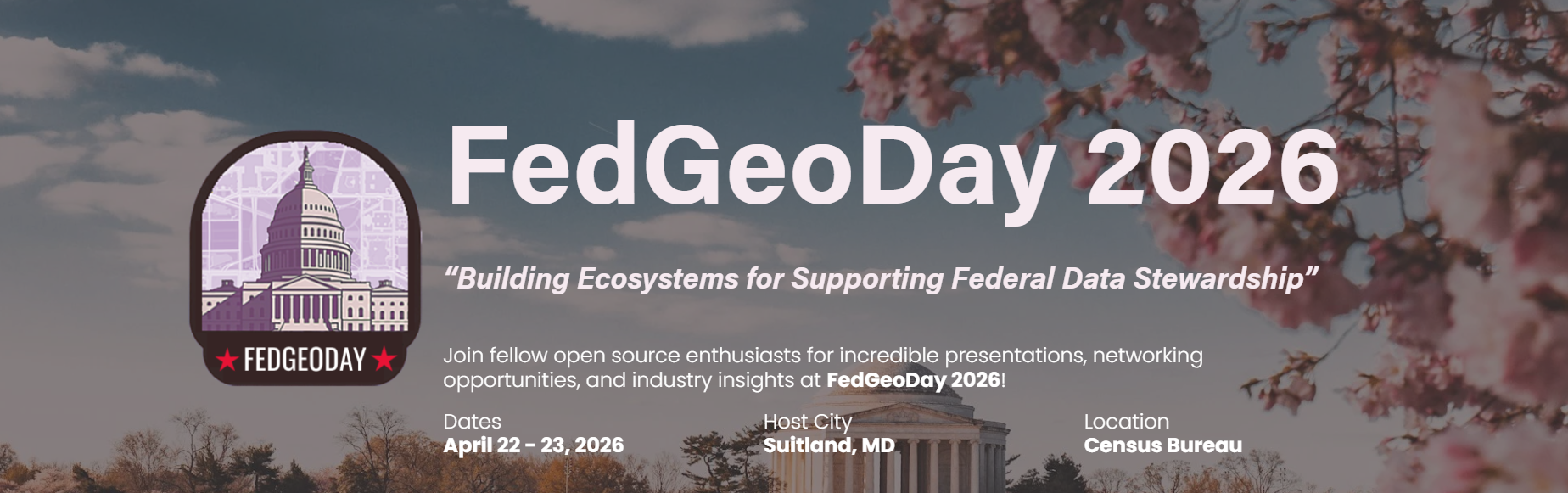
FedGeoDay 2026: Building Ecosystems for Supporting Federal Data Stewardship
The theme selected for FedGeoDay 2026: "Building Ecosystems for Supporting Federal Data Stewardship": could not be more timely or more critical. As federal agencies grapple with exponentially expanding volumes of geospatial data from satellite constellations, aerial surveys, ground sensors, crowdsourced platforms, and synthetic aperture radar systems, the technical and organizational challenges of managing, sharing, securing, and stewarding these datasets have become paramount concerns that transcend individual agency boundaries.
Effective data stewardship requires more than technological infrastructure; it demands collaborative ecosystems that span organizational silos, standardized frameworks that enable interoperability, governance structures that balance accessibility with security, and cultural shifts that prioritize data as a strategic asset rather than a departmental resource. These are precisely the conversations that FedGeoDay 2026 will facilitate through presentations, workshops, and networking sessions designed to address real-world operational challenges while showcasing innovative solutions already delivering measurable impact.
The event details are as follows:
Dates: April 22–23, 2026
Location: U.S. Census Bureau Headquarters, Suitland, Maryland
Theme: "Building Ecosystems for Supporting Federal Data Stewardship"
Keynote Speaker: Denice Ross, Senior Fellow at the Federation of American Scientists: a distinguished 25-year veteran of leveraging data in service of public interest who has served in senior leadership roles, including Deputy U.S. Chief Technology Officer and U.S. Chief Data Scientist
Whether attendees are seasoned geospatial intelligence professionals with decades of experience implementing complex analytical workflows, program managers seeking to understand emerging technologies and best practices, or technical practitioners beginning to explore how open-source tools can transform their agency's mission delivery, FedGeoDay 2026 offers tailored content, peer networking opportunities, and exposure to cutting-edge solutions addressing the field's most pressing challenges.
Registration and Sponsorship: Secure Your Place in the Ecosystem
Registration for FedGeoDay 2026 is now open. Federal employees, contractors, industry partners, academic researchers, nonprofit organizations, and anyone committed to advancing open geospatial ecosystems within government are encouraged to secure their spots for two days of presentations, technical workshops, case study sessions, and networking opportunities with the federal geospatial community's most accomplished practitioners and innovative thinkers.
For organizations invested in the future of federal geospatial intelligence and analytics, sponsorship opportunities remain available at multiple investment levels. Sponsorship provides visibility alongside the premier federal agencies and leading technology companies that are actively shaping the future of government geospatial capabilities, while simultaneously supporting an event that delivers genuine value to the entire community through knowledge sharing, collaboration, and collective advancement of the field.
Complete event information, registration details, and sponsorship opportunities are available at www.fedgeo.us.
The New Light Technologies team looks forward to gathering with the federal geospatial community at the Census Bureau in Suitland this April for what promises to be the most impactful FedGeoDay yet. The conversations, connections, and collaborations that emerge from these two days will shape the trajectory of federal geospatial intelligence and analytics for years to come.
About New Light Technologies, Inc. (NLT)
New Light Technologies, Inc. (NLT) is a mission-focused technology, science, and product company with over 25 years of experience delivering operational solutions for emergency management, disaster response, climate resilience, and complex data operations at scale. NLT partners with commercial, federal, state, local, and international organizations to strengthen preparedness, accelerate response, and support long-term recovery in high-stakes, real-world environments.
NLT designs, builds, and operates secure, cloud-native platforms and managed services that transform raw, time-sensitive data into actionable intelligence. Its solutions operationalize geospatial analytics, data integration, automation, and decision-support workflows: enabling rapid imagery ingestion, damage assessment, common operating pictures, infrastructure monitoring, and secure collaboration across distributed teams.
With deep roots in geospatial intelligence, data science, DevSecOps, and applied research, NLT bridges advanced technology with on-the-ground operational workflows. The company's products and services are built to perform under pressure: supporting emergency operations centers, field teams, analysts, and decision-makers when speed, accuracy, and reliability matter most.
Headquartered in Washington, D.C., New Light Technologies is a trusted partner to public and private sector organizations worldwide. NLT is committed to delivering resilient, scalable solutions that help agencies and enterprises adapt to evolving risks, manage complexity, and better serve communities before, during, and after critical events.
Ready to explore how NLT can strengthen your organization's geospatial intelligence and data stewardship capabilities? Contact our team for a discovery call to discuss your operational challenges and explore tailored solutions: https://newlighttechnologies.com/contact-us