Data Science & Integration
NLT's PARTICIPATION at Baltimore Sustainability Open House
Explore how NLT's participation at the Baltimore Sustainability Open House
NLT, funded by the World Bank, developed an open-source tool to predict the coverage of OSM building footprints.
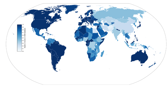
While significant portions of the World have already been mapped in OpenStreetMap (OSM), many areas around the world are still not mapped (or not fully mapped). In addition, the completeness of coverage of OSM features varies in space and time. For example, the coverage of remote and rural areas is often lower than that of highly populated urban areas, and the coverage of developing countries tends to be lower than that of developed countries. These under-covered areas are often precisely where the most vulnerable, disaster-exposed populations live. Furthermore, sustainable development and infrastructure investments in these areas require accurate and up-to-date information on the locations of homes, hospitals, roads and more.
The only sustainable way to address the need for a comprehensive, publicly available, large-scale datasets of these areas (such as in OSM) is to rely on the crowd to collect data. Making it easier to mobilize and support volunteers is therefore an important goal for many development actors. New Light Technologies (NLT), funded by the World Bank, developed an open-source tool to predict the coverage of OSM building footprints with the goal to identify areas around the world that still lack a comprehensive and complete OSM mapping. The method, first documented in Remote Sensing journal, uses publicly available data as inputs into machine learning models which predict the number of buildings that “should” be in an area and compare it to the actual OSM coverage. Proven initially on small Caribbean island states, the method is now being demonstrated at the larger scale of of all Nepal.
Next week, join us for an informative and illustrative webinar on Thursday, September 3, at 11am, discussing the latest developments in predicting the OSM Data Completeness. The panel will discuss how this type of data and the results of this project can be translated to actual decision and policy making in the context of Nepal and elsewhere. Speakers will include NLT’s Chief Scientist, Dr. Ran Goldblatt, along with the NLT Global Team; Robert Banick, Geospatial Technology Specialist at the World Bank; and Walker Kosmidou-Bradley, Geographer at the World Bank.
For more info, see our registration page!
Sign up today!
New Light Technologies, Inc. (NLT) provides comprehensive information technology solutions for clients in government, commercial, and non-profit sectors. NLT specializes in DevSecOps enterprise-scale systems integration, development, management, and staffing and offers a unique range of capabilities from Infrastructure Modernization and Cloud Computing to Big Data Analytics, Geospatial Information Systems, and the Development of Software and Web-based Visualization Platforms.
NLT is an authorized reseller and implementation consulting firm with leading geospatial technology and data providers such as ESRI and MapBox as well as a member of leading industry associations including URISA and USGIF. Our team’s approach is to meet our customers’ challenges where they are and help them get where they need to be based on their unique technological and regulatory requirements while meeting their budgetary requirements. Visit our website for a sampling of our customers and projects. You can request a free consultation with our team while you are there.
In today’s rapidly evolving technological world, successfully developing and deploying digital geospatial software technologies and integrating disparate data across large complex enterprises with diverse user requirements is a challenge. Our innovative award-winning solutions for real-time integrated analytics lead the way in developing highly scalable geospatial solutions for the future. Visit our website for details and contact information.
Explore how NLT's participation at the Baltimore Sustainability Open House
Exciting news about the launch of DC Compass, an AI-powered geospatial portal in partnership with Esri.
NLT and CEGA are teaming up to harness today’s open-source geospatial sea change for poverty alleviation and global development.