


.jpg?width=1200&length=1200&name=EsriUC2023_8%20(1).jpg)


Industry Events
NLT Proudly Sponsors Next Week’s Geo4Dev Conference
NLT proudly sponsors the Geo4Dev Conference, focusing on global humanitarian response to migration.
Hear the highlights of ESRI UC 2023, from collaborations to big data solutions and showcasing disaster risk products like IMPACT and BEAD.

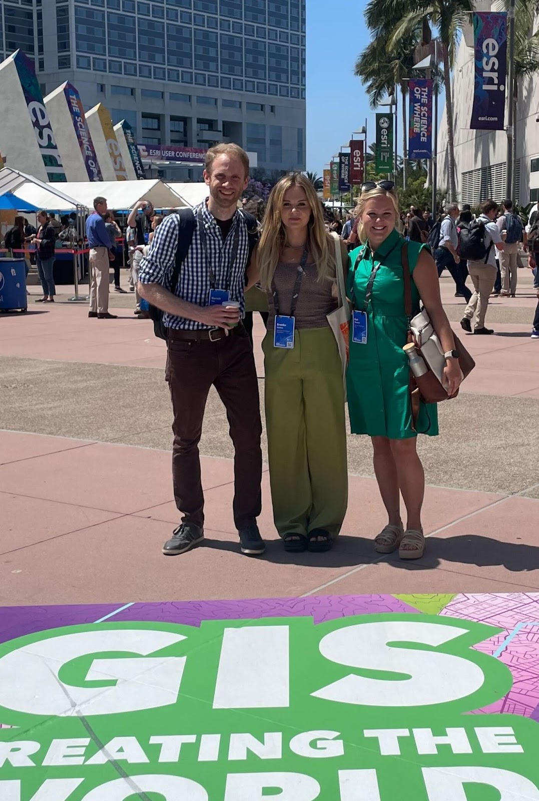
This year, Kari, Brooke, and Garret had the opportunity to attend ESRI UC. Conferences are crucial for our remote NLT team to collaborate in person, strengthen relationships, learn, present our work, and meet with the geospatial family.
This year's conference allowed us to strengthen our presence with young geospatial professional organizations, meet with ESRI product owners to mitigate technology roadblocks, and collaborate with partners showcasing NLT’s current Disaster Risk Products for extracting, alerting, and monitoring at-risk areas. These products are IMPACT and Business Economic Analysis Dashboard - BEAD. At Esri UC’s exposition hall, learning sessions, and plenary, our team was able to take home valuable information and resources to improve these products.
Streamline hosting, utilizing, and visualizing Big Data for Disaster Economic Risk Products.
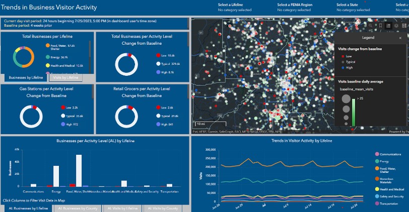
The conference allowed us to meet with FEMA’s ESRI Account Manager Stuart Rucker and Colin Cate to discuss hosting POI Business Data (Data Axle and Foursquare) for the FEMA OB3I NBEOC Economic Impact product BEAD within the ESRI AGOL framework. The conversation led us to cross the expo hall to the Living Atlas team, Daina Lavery, Lisa Berry, and Paul Dodd. Within 30 minutes, the team solved our big data hosting challenges by providing several workflow options, article references, resources to reach out to, and a stimulating conversation on BIG DATA.
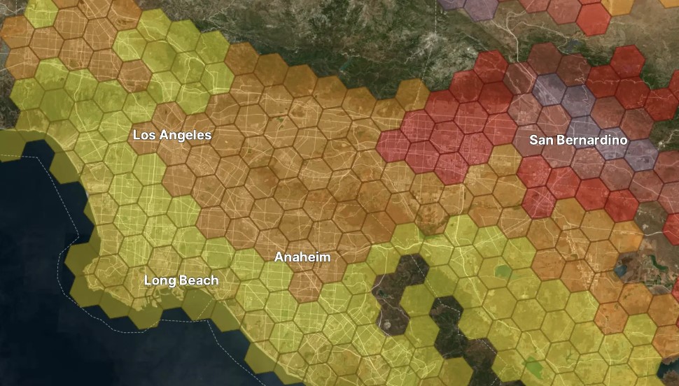
Incident Management, Prioritization, Alerting, and Coordination Tool - IMPACT

At Esri UC, NLT met with partners and friends: Planet, URSA Space Systems, Waldo Air, URISA, and others to demo and discuss collaboration projects with the disaster risk framework IMPACT.
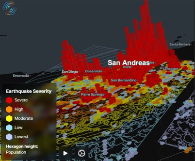
Connecting dots of past, present, and future
Past: Tests and validates disaster models using historic damaged products.
Present: Continuously monitors disasters and alerts clients through text and social media.IMPACT is constantly evolving and growing its capabilities to reach the above goals. The team is also dedicated to customer support and partner relationships.
At Esri UC, a list of future improvements was developed and is being integrated into our platform:
ESRI Young Professional Network and URISA Vanguard Cabinet

At Esri UC, our NLT team member, Brooke, also took a substantial role as a Young Professionals Network (YPN) session panelist.
"I had the opportunity to be a panelist on the YPN Session: Leveraging Social Media to Advance Your Career. This session covered strategies and best practices for using social media as a tool to land your next job opportunity. I am passionate about this topic as I see social media as a binary technology. Although social media can be a distraction from living in the present and reaching goals- when used correctly for work, its power to help market our geospatial work and team is outstanding.

This year, I also had the opportunity to meet with my URISA Vanguard Cabinet team in person. I took pleasure in using social media as a creative outlet to inspire young professionals and express my views of what's important from the conference. Documenting the sessions, new technology, and network interactions gave others my perspective of the conference through URISA’s social media platforms. Writing blogs and social media posts can help first-timers make the most of their experience. For me, these blogs serve as a way of gratitude and reflection for the many times I have been able to join these conferences- thanks to NLT’s full-on support."
Thirteen Tips to make the most out of the ESRI UC Conference - Brooke Hatcher, ArcNews, and VC.
NLT proudly sponsors the Geo4Dev Conference, focusing on global humanitarian response to migration.
NLT celebrates GIS Day events nationwide, showcasing the impact of geospatial technologies in humanitarian efforts and disaster management.
NLT announces a strategic partnership with Fugue to deliver public cloud configuration, drift detection, active drift enforcement and more.